SS United States reef: what 180 feet deep means, and what scientists will study
The 990-foot liner rests at a reported 180-foot bottom depth, with its uppermost deck near 60 feet. A sourced guide to the sinking and the research still ahead.
The SS United States has completed its last voyage, becoming an artificial reef off Florida's Destin-Fort Walton Beach. The scientific story is only beginning. A large new structure on the seabed gives researchers a chance to follow changes in its water chemistry and biological communities from the start, rather than arriving at a shipwreck after an ecosystem has already formed.
The sinking happened on 11 November 2026. Okaloosa County's 12 November announcement confirms the completed deployment, and NPR's report that day describes the retired liner disappearing beneath the surface at about 10 p.m. Eastern the previous evening. The county and Woods Hole Oceanographic Institution, or WHOI, call it the world's largest artificial reef. We have not independently ranked artificial reefs worldwide.
A 990-foot length is not a 990-foot depth
WHOI describes the ship as 990 feet long. That is its bow-to-stern dimension, not its height or the depth of the water.
The county says the ship rests at approximately 180 feet deep, while its uppermost deck is at approximately 60 feet. Early sonar and remotely operated vehicle inspections indicated that it was sitting upright on the bottom. Those different figures explain why saying only that the ship is "180 feet underwater" can be misleading: the uppermost part is much closer to the surface than the bottom.
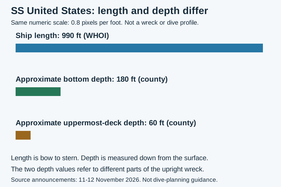
Original Omnistu numeric comparison. Length runs along a ship; depth runs down from the surface. The bars compare numbers only, not the orientation or shape of the wreck. Figures are not dive-planning guidance.
WHOI describes the planned deployment site as about 22 nautical miles southwest of Destin East Pass. The county's completed-deployment announcement places the reef approximately 22 nautical miles offshore. We have not surveyed its position, depth or present condition. This article is not a navigation or diving guide, and the announcement's access information should not be treated as a current safety clearance.
A deliberate sinking, not an accidental wreck
Okaloosa County bought the ship in 2024, according to WHOI. NPR describes the earlier effort to turn it into a hotel or museum and the county's decision to sink it. The liner had made its maiden voyage in 1952, when it set the transatlantic speed record described in NPR's account.
The county says intake valves were opened to let water fill the vessel. NPR quotes the marine engineering contractor Coleen Marine describing repairs to hull openings and work to let air escape so that the ship would descend upright. These are attributed accounts of the preparation and deployment, not our engineering inspection of the vessel.
WHOI says the ship underwent extensive remediation following best practices from the EPA, Maritime Administration, Army Corps of Engineers, and Gulf and Atlantic States Marine Fisheries Commission. We have not audited those standards or the remediation work. A statement that preparation followed best practices does not by itself establish an environmental outcome.
What scientists plan to measure
WHOI's 11 November announcement describes a multi-year effort led by marine biologist Kirstin Meyer-Kaiser, funded by NOAA and WHOI. Its stated work includes:
- An early baseline. Within the first month, the team plans to document the ship's physical condition, surrounding chemistry and early biological communities. The announcement describes a plan, not proof that the baseline work has already finished.
- Water sampling at 132 locations. Researchers plan to measure elements such as iron, manganese and nickel around the ship. WHOI explains that steel corrosion releases metals and that some may act as micronutrients supporting coral growth. The study is intended to investigate effects, not announce that corrosion is harmless or that coral growth has already increased.
- Annual return visits. The team plans to collect samples and photograph the site over time. A recreational-diver citizen-science program is a long-term goal, not a service this article has verified as operating.
WHOI also describes a separate sediment and water microbe-sampling mission to be led by Leila Hamdan at the University of Southern Mississippi.
The distinction between a newly placed structure and a mature reef matters. Organisms settling on the surface, changes in water chemistry, and the development of larger biological communities are things the researchers intend to track. A new habitat opportunity is not the same as measured long-term biodiversity gains.
What is confirmed, and what is still ahead
The county confirms a completed deployment and reports early upright positioning. WHOI describes the research design, and NPR supplies a reported account of the final sinking and the ship's history. None of those sources provides completed long-term ecosystem results.
The county also describes a future SS United States Museum and Visitor Experience being developed with the SS United States Conservancy. That remains a future project in the source, not a museum we have verified as open.
The useful next story will be the measurements: what colonizes the ship, how the surrounding water changes, and what repeat observations show. For now, those are research questions, not settled benefits.
Prepared with AI assistance and reviewed on 19 November 2026. The article relies on the cited sources, not a site visit or independent underwater survey.
Sources
- Okaloosa County, official completed-deployment announcement, 12 November 2026: https://www.myokaloosa.com/sites/default/files/Users/piouser/SSUS%20Release%20-SuccessfulDeployment-1.pdf
- WHOI, research announcement, 11 November 2026: https://www.whoi.edu/press-room/news-release/ssus-reef/
- NPR, reported account of the final voyage, 12 November 2026: https://www.npr.org/2026/11/12/g-s1-153219/the-deliberate-sinking-of-the-ss-united-states